AS MELHORES SOLUÇÕES
Transform your data into strategic decisions
Descubra como nossas soluções em geoinformação podem impulsionar seu negócio. Entre em contato para um orçamento personalizado.
Transform your data into strategic decisions
Discover how our geoinformation solutions can boost your business. Contact us for a personalized quote.

Conheça o Gisdeal Mobility®
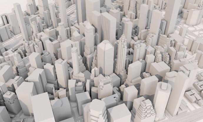
Solução competa para simulação de tráfego urbano totalmente integrado com a plataforma ArcGIS propiciando escalabilidade para análises de diferentes cenários, visualização realística e controle interativo em tempo real em um ambiente familiar. Algorítmos de micro simulação amplamente reconhecidos na indústria e comunidade científica garantem uma representação acurada da mobilidade urbana. Exclusivos pacotes adicionais de consultoria e treinamento estão disponíveis para garantir o sucesso em cada etapa do projeto desde a implantação até a operação.
Meet Gisdeal Mobility®
Complete solution for fully integrated urban traffic simulation with the ArcGIS platform providing scalability for analysis of different scenarios, Realistic visualization and real-time interactive control in a familiar environment. Micro-simulation algorithms widely recognized in the industry and scientific community ensure an accurate representation of urban mobility. Exclusive additional consulting and training packages are available to ensure success at every stage of the project from implementation to operation.

Gisdeal Mobility Portal®
Manage and Visualize Traffic Simulations Anywhewere
Gisdeal Mobility Portal® is a scalable web platform that allows you to manage, visualize and analyze urban traffic simulations in an accessible and collaborative way.

Gisdeal Mobility Pro®
Urban Mobility Simulation and Analysis
Gisdeal Mobility Pro® is an extension for ArcGIS Pro that transforms data into actionable insights for urban mobility management.

Gisdeal Mobility Pro®
Urban Mobility Simulation and Analysis
Gisdeal Mobility Pro® is an extension for ArcGIS Pro that transforms data into actionable insights for urban mobility management.

Gisdeal Mobility Portal®
Manage and Visualize Traffic Simulations Anywhewere
Gisdeal Mobility Portal® is a scalable web platform that allows you to manage, visualize and analyze urban traffic simulations in an accessible and collaborative way.
Public Private
We serve public and private organizations with geoinformation solutions that optimize municipal, state and federal management. Public safety, health, infrastructure, urban planning, ensuring efficiency and accuracy.
Utilities
We support utility companies such as electricity, water, and telecommunications with geospatial solutions that assist in the management of distribution networks, planning, operations, land, asset and infrastructure management.
Exploration
We have experience in the natural resources exploration market, customizing advanced solutions and data analysis for mining, forestry, and oil, facilitating resource management, environmental monitoring, and operations management.
Environment
Our solutions assist in the sustainable management of preservation areas, such as forests, monitoring of conservation areas, environmental compensation, carbon credit, promoting social justice and environmentally responsible practices.
Our Work
At Gisdeal, we simplify the process of creating and implementing geoinformation projects. From budgeting to delivery, our focus is to provide an efficient and hassle-free experience for our clients.
Simple e Direct Quotes:
We offer a transparent and fast estimation process, allowing you to understand the costs and benefits of your project from the beginning.
Project Monitoring System:
Our project tracking system ensures you are always informed about progress and milestones, making management and decision-making easier.
Delivery Made Easy
We prioritize the timely and efficient delivery of projects, ensuring that you receive ready-to-use solutions, in a practical and hassle-free way.


Solution Development and Deep Customization
Full Stack
Extensions and Add-Ins
ArcGIS systems architecture, installation and diagnostics
High Scalability
Azure Cloud
System Integrations and Data ETL
CRM/ERP
Utility Network
HOW CAN WE HELP YOU?
We are experts
At Gisdeal, we offer specialized services in architecture, installation and diagnostics of ArcGIS systems. Our expertise ensures high scalability and integration with Azure Cloud, providing a robust and efficient infrastructure for your geoinformation needs.
HOW CAN WE HELP YOU?
Somos especialistas
At Gisdeal, we offer specialized services in architecture, installation and diagnostics of ArcGIS systems. Our expertise ensures high scalability and integration with Azure Cloud, providing a robust and efficient infrastructure for your geoinformation needs.
Spatial analysis with Big Data
Velocity
GeoAnalytics
3D Modeling and Visualization
Drone2Map/Reality Studio/Blender
ArcGIS Pro/Gaming/VR SDKs/Indoors
Artificial Intelligence
GeoAI
Machine Learning
MEET GISDEAL
Our History and Team
Gisdeal is a reference in geoinformation solutions. Our trajectory is marked by innovation and commitment to excellence, offering products and consultancy that transform data into strategic insights.
Our team is comprised of highly qualified specialists dedicated to delivering exceptional results. We operate in a variety of segments, including public and private sectors, utilities, mineral exploration and forestry. We are ready to help your company reach new heights with innovative and customized geoinformation solutions.
Expertise in team building and leadership;
Coordination and management of complex projects
Projects
 14
14
Certifications
Training Courses
Treine sua equipe com nossos especialistas
Consultorias e Treinamentos
Consultorias
We offer technical and strategic consultancy to optimize your
geoinformation solutions, ensuring success in your projects.
Treinamentos
Empower your team with our personalized geotechnology training, adapted to the specific needs of your business.
Elaboração de Propostas
Contact us for help in preparing technical proposals and bidding support for a smooth sourcing process with specialized professionals and competitive prices.
Consulting
We offer technical and strategic consultancy to optimize your
geoinformation solutions, ensuring success in your projects.
Training
Empower your team with our personalized geotechnology training, adapted to the specific needs of your business.
Preparation of Proposals & RFPs
Contact us for help in preparing technical proposals and bidding support for a smooth sourcing process with specialized professionals and competitive prices.

Level Up your team with our experts!
Consulting and Training
Public/Private Cloud
High scalability, security and performance with advanced certification with Microsoft Azure Cloud architecture.
Esri ArcGIS
We offer robust solutions and expertise with ArcGIS, the leading geographic information systems platform.
3D Modeling
Experience with ArcGIS Pro and Blender for 3D modeling and realistic visualizations, enhancing immersion and spatial analysis.


DISCOVER OUR TOOLSET
We work with cutting-edge technologies


Digital Twins
We transform drone-captured data into Reality Capture visualizations with incredible detail and realism.
Data ETL
We automate and integrate data and analysis processes with the best tools for the job such as Python and FME.
Data Pipelines
We build scalable and robust real-time data pipelines for critical workflows.

